Seismic Surveys Are the Future of the Natural Gas Industry: Here’s Why and How
What Is a Seismic Survey?
A seismic survey allows for the production of detailed images pertaining to the numerous types of rocks and their location beneath the surface of the earth. Such information has been a game-changer for oil and gas explorers, as it allows for the detection of the size and location of oil and natural gas reservoirs to make decisions about further exploration activities in the area.
How Is a Seismic Survey Conducted?
A seismic survey makes use of sound waves that are created on the ground surface following a predetermined line by making use of an energy source. These waves are bounced off rock formations that are underground, and those that return are captured for analysis later on by recording sensors. The time taken for the seismic waves to return from subsurface formations back to the surface area is then analyzed, and from this information, valuable details can be gained regarding rock types, fluids in rock formations, or gases existing in subsurface formations and anomalies so that exploration activities may be pursued.
A seismic survey can either be performed onshore (land), offshore (marine), or what in what are referred to as “transition zones,” which are shallow water areas, like river estuaries or beaches.
Marine Seismic Surveys
Marine seismic surveys help to detect geological features below the seafloor. They are conducted by sending out acoustic waves into the numerous rock layers that are buried beneath the seafloor. The time taken for each wave to return is recorded, as well as the features of the returning waves. In marine seismic surveys, the source of energy is usually a range of air-chambers of various sizes that are filled with compressed air. A seismic survey vessel is used to tow the energy source through water, which releases bursts of high-pressure energy into the water. Hydrophones are spaced out along a series of cables to record the waves that return.
Land Seismic Surveys
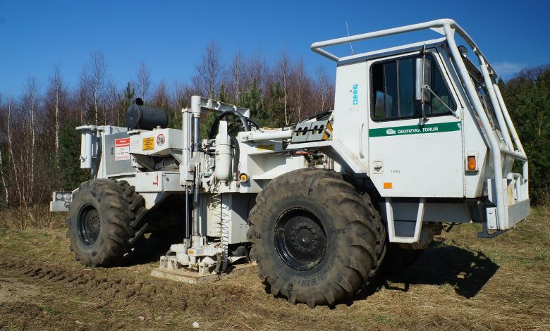
Seismic surveys on land make use of energy sources that are usually truck-mounted vibrators or explosives that are placed in shot holes, which are drilled using portable or truck-mounted drills. The receivers used to capture returning waves are geophones, similar to tiny microphones inserted in soil to assess ground motion. The geophones used are usually laid out along a predetermined grid, and the information recorded gives an indication of the depth of structures too. They are generally done in sensitive regions without causing damage to buildings or the ecosystem.
Data acquisition, data processing, and data interpretation are the three phases involved in conducting seismic surveys. Data capturing is done by making use of hydrophones and geophones that are highly sensitive. These devices are used in clusters that optimize the receiving and recording of the sound waves. Processing of the data acquired necessitates the use of sophisticated software, advanced computers, and specialized skills.
Types of Seismic Surveys

By Result Dimensions
Results from seismic surveys may be of three different types: 2-D, 3-D, and 4-D. Each has its own requirements in terms of capturing data, interpreting it, and presenting it in a particular manner. The use of GPS technology has also made it possible to track surface locations accurately so that information drawn from it is as exact as possible.
2-D Surveys
2-D surveys are the conventional type of seismic surveys of data collection and analysis where data is presented in the form of 2-dimensional maps without providing information regarding depth/thickness of the formation. They typically use a single line of energy source and receiver points where surveys are conducted along a single line on the ground, and 2-D seismic data shows the subsurface geology along that line.
3-D Surveys
In the case of 3-D surveys, multiple synchronized energy sources and receiver points are used. Although the basic method is the same, in 3-D surveys, the energy source and receiver points are laid out across the area in a grid. As a result, the reflections recorded at different receiver points are from different directions, which can be analyzed by advanced computer programs to produce 3-D images of the subsurface, allowing for the perception of depth and thickness of the formation.
4-D Surveys
4-D surveys also make use of multiple synchronized energy sources and receiver points with the addition of time. 4-D surveys are enhanced 3-D surveys where the data collected is more sensitive to the timing of the results in comparison to other survey types. The information generated from data interpretation is even more detailed when compared to 3-D, particularly relating to thickness, size, and shape of the formation.
By Detail
On the Outer Continental Shelf regions, two main types of seismic surveys can be done:
Deep Penetration Seismic Surveys
In deep penetration seismic surveys, vessels are used to tow a range of airguns that make use of a low-frequency source and give out high energy acoustic pulses in the seafloor over prolonged durations. Such surveys can be used to penetrate deep into the subsurface by several thousands of meters, and receivers capture reflected waves to produce images of deep geological features.
High-Resolution Seismic Surveys
High-resolution seismic surveys, on the other hand, make use of high-frequency acoustic signals to create images of the bottom of the sea, as well as shallow regions just below the bottom of the ocean, in greater detail.
By Energy Patterns
Depending on how the energy travels, seismic surveys may be based on:
Reflection Surveys
In reflection surveys, the energy in large part travels vertically and is reflected from interfaces existing between various types of rocks.
Refraction Surveys
Refraction surveys are less commonly used. Here, the energy passes as a head wave along the boundaries of two layers before it returns to the surface. Such surveys can help to produce images of deep structures in situations where there’s a shortcoming in reflection data.

Benefits of Using Seismic Surveys
With the valuable insights that can be generated through the use of seismic surveys, it’s no wonder they’re growing in popularity. Seismic surveys hold a lot of promise for the future of the natural gas industry for a myriad of reasons:
Increase Supply for Demand
With the human population increasing every day, so has our need for energy resources. Natural gas is used in a variety of activities involved in our daily lives and is needed to keep up with the needs of an ever-increasing population. Whether it is for our homes, our businesses, or even for items that are lesser-known, such as plastics and cosmetics, we depend on natural gas to meet our energy requirements. Before these energy requirements can be met, however, they need to be located, and seismic surveys help to do just that.
Improve Accuracy
Seismic surveys serve as an important first step in the entire life cycle process of a well. The data generated from seismic surveys help to identify more accurately whether a specific geological formation is worth exploring for resources. Using this information, geophysicists can map rock formations and generate 2-D, 3-D, and even 4-D images of structures that allow for better understanding of depth, thickness, and other features of formations, which could be a potential resource reservoir.
Seismic surveys also allow for more accurate resource estimation to be done. For example, 9.57 billion barrels of oil reserved were estimated to be found in the Gulf of Mexico in 1987, but in 2011, with the use of data from seismic surveys and exploratory drilling, that number was found to stand at 48.4 billion barrels of oil, showing a fivefold increase in estimates.
Such detailed understanding is necessary to ensure accurate data is made available to concerned parties so that optimum utilization of natural gas resources can be made possible.
Less Time Consuming
Prior to the use of seismic surveys to locate and analyze the potential of an area to yield energy resources, wells were drilled in the hope of finding reservoirs, with the result being that many dry wells were also dug up. Allocation of resources to this task resulted in wasted time and efforts upon the discovery of having drilled dry wells. With advances in technology, seismic surveys allow for better utilization of time by dedicating resources to drilling only when an area has been surveyed and deemed viable as a source of energy reserve that can be extracted for human use.
Risk Reduction
While seismic surveys are regarded by many to be environmental risks, they can actually help in the reduction of risks to the environment in many ways.
Due to greater accuracy of data made available through the use of seismic surveys, the likelihood of exploratory wells drilled in areas surveyed and finding reservoirs is higher, which means that fewer wells need to be drilled, which reduces the overall exploration footprint.
Activities involved in seismic surveys are generally transitory and temporary, which means that they are the least intrusive means of understanding where natural gas resources could potentially exist. For offshore surveys, the sounds used are comparable to many marine sounds that occur naturally, including sounds that marine animals make as well. They’re low frequency and, therefore, least intrusive.
The techniques used in seismic surveys have replaced earlier practices of exploding dynamite underground. Damage from underground explosions can also be mitigated through the use of electric vibrators or thumpers. Mechanical vibroseis, a method that’s currently used instead of dynamite charges, also helps to lessen the impact on the environment. Environmental risks are also reduced through the use of seismic equipment that is low impact and helicopter portable.
Hazards of drilling in a particular area can also be highlighted through the use of seismic surveys that provide access to high-resolution data of such regions. Some characteristics that may prove hazardous and should, therefore, be avoided in rig positioning include: sea bottom that dips steeply or is unstable, faults, shallow gas pockets, and abnormally pressured sands.
Another way that conducting seismic surveys helps in risk reduction is through the prediction of fluid and rock fracture pressures of the subsurface area through 3-D seismic data, as well as offset well data, even before the drilling of a new well. Such information can help to ensure that there are no unanticipated gushes of high-pressure fluids into the well at the time of drilling.
More Efficient Planning
The data that is made available through the use of seismic surveys helps in planning better so that better decisions can be made. The efficient extraction of natural gas translates into needing to drill fewer wells.
Data from seismic surveys can also aid decision making of companies in terms of deciding whether an exploratory well in the area is needed to be drilled, whether more surveys need to be conducted in the area prior to drilling, or whether the area should not be explored further, as it holds no promise.
More Job Opportunities
The natural gas industry provides scope for job opportunities to people, and this can help to boost national security, provide a secure energy future, and benefit nations as a whole. The use of seismic surveys is a starting point in this direction for the tremendous promise it holds for the natural gas industry.
Cost-Effective
While seismic surveys do involve costs, they’re cost-effective in the long run due to all of the advantages they offer, as described above. They provide valuable data that can be used to make decisions and save time and effort in drilling dry wells. They help to excavate resources that are crucial for meeting human needs, and therefore, the benefits derived from their use far outweigh the cost involved in using the advanced technologies to conduct them.

Regulations Governing the Use of Seismic Surveys
In order to ensure that seismic surveys are made use of in the best manner possible and minimize the damage to the environment so that natural gas can continue to be obtained in an efficient manner, regulations have been put in place by different nations.
For onshore seismic surveys to be conducted, companies are required to get surface access agreements directly from landowners who will be impacted by their exploration activities.
For offshore seismic surveys, only areas that have government licenses can be explored so that the impact on marine life can be kept in check. Prior to beginning any activity, an analysis is done to detect any animal movement or behavior patterns. Areas that raise concerns in terms of marine life are then closed for any seismic surveys to be conducted and only opened to surveying when clear. The process generally is required to begin with a “soft-start,” where the sound is steadily raised to full operational levels, allowing for animals to leave the region.
Ships are also expected to approach slowly so that marine animals get time to move away. Other measures that attempt to check the impact of seismic surveys on marine life forms include survey timing, acoustic monitoring, low power zones, and observation zones so that marine life is not negatively impacted.
Safety zones are declared in the U.S., Australia, and Europe for operating vessels for seismic surveys, with on-board observers monitoring the entry of any animals into the zone, which can range from 150 meters to 3 kilometers, based on sound propagation properties of the local area and the intensity of airgun arrays.
The Marine Mammal Protection Act of 1972 has measures in place to make certain that the numbers of marine mammals are kept steady or that they’re restored to the levels of their optimum sustainable population.
As per the National Environmental Policy Act, all federal agencies need to assess the environmental costs of proposed projects, as well as consider alternative solutions to proposed projects. The information gathered from a careful consideration of the proposed project needs to be accessible by the public. As per the National Environmental Policy Act, the Bureau of Ocean Energy Management is required to analyze the environmental costs of proposed projects before granting approvals for conducting seismic surveys to explore natural gas reserves.
The Endangered Species Act makes it necessary for federal agencies authorizing any action to ensure that the proposed projects don’t come at the cost of threatened/endangered species or destroy/negatively impact their natural habitat.
The Bureau of Ocean Energy Management has an approval process in place to review applications for those wanting to undertake seismic surveys in different regions of the Outer Continental Shelf. The Bureau of Ocean Energy Management also consults with state officials, the National Aeronautics and Space Administration, and the Department of Defense to check if the proposed project could interfere with civil aerospace or defense activities of the region. Incidental take authorizations are also generally required before permission is given to conduct a seismic survey in a particular area.
In Canada, the Statement of Canadian Practice guides the use of seismic vessels, as well as their operators for the mitigation of sound generated through seismic surveys with the help of mitigation measures from the Marine Environment Outlines. Comprehensive environmental assessments are done before permits are granted.
In Australia, evaluation of environmental costs of seismic surveys is done under the Offshore Petroleum and Greenhouse Gas Storage Act, as well as regulations from the National Offshore Petroleum Safety and Environmental Management Authority.
With all the benefits that seismic surveys offer and the regulations in place to ensure safety and risk minimization to the environment, they hold a huge potential for the future of the natural gas industry.