Fossil Fuels and Ocean Dead Zones: Is There a Connection?
The Rising Prevalence of Dead Zones
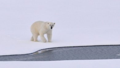
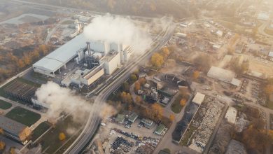
Oceanic dead zones have been becoming more prevalent in recent years. Scientists says increasing global carbon emissions and runoff from fertilizers made from fossil fuels have had a detrimental impact on vast regions of the ocean. In addition to ocean acidification caused by acid rain and excess carbon dioxide already in the atmosphere, runoff from fossil fuels and products directly developed from fossil fuels have been killing large areas of sea life. Dead zones located within the Sea of Cortez, the Chesapeake Bay, and the Gulf of Mexico are a few of the regions that have experienced some of the biggest impacts.

The Sea of Cortez Dead Zone
Over the last decade, runoff pollution from fossil fuels has threatened the biologically diverse Sea of Cortez within the Gulf of California. One of the main contributors of pollution within the Sea of Cortez comes as a result of petroleum-based fertilizer runoff from large farms located near coastal areas and waterways that flow into this body of water. Partially due to the unique geography of the Gulf of California, the process of eutrophication has been intensified, which has disrupted the fragile marine ecosystems and produced widespread dead zones within the Sea of Cortez (Shwartz, 2005).
The Fossil Fuel Connection
Nitrogen-rich runoff from agricultural areas has increased large algae blooms in the Sea of Cortez (Beman et al, 2005). Algae blooms are often referred to as “red tides” because of their distinctive appearance and their ability to excrete a number of harsh toxins into the air and water. These toxins are extremely detrimental to marine life and can even make humans sick (WWF, 2017). In addition to petroleum-based nitrogen fertilizer runoff from farms, scientists say that changing development patterns and urbanization can also intensify algae problems.

Fossil Fuels aren’t the Only Culprit
Fossil fuels aren’t the only cause of oceanic dead zones. Urban development threatens water quality (Frumkin, 2002). As green landscapes are destroyed to make way for subdivisions, roadways, industrial facilities, and large swaths of impervious areas, rainfall is less likely to be absorbed into groundwater systems. When rainfall is unable to be effectively absorbed into groundwater systems, the water moves across impervious surfaces, picks up a number of non-point sources of pollution, and carries the pollutants to surface waters rather than slowly permeating into the ground (Benfield et al, 1999). As the amount of impervious surface area has increased within the coastal areas surrounding the Sea of Cortez, the volume and velocity of runoff also increases, which can lead to erosion and flooding. As erosion and flooding increase, even more pollutants are able to flow into the Sea of Cortez.

The Gulf of Mexico Dead Zone
The dead zone within the Gulf of Mexico is a man-made problem that has adversely impacted around 8,776 square miles surrounding the Mississippi Delta (NOAA, 2017). The dead zone is essentially a biological desert that has been caused by a buildup of excess nitrogen, phosphorus, and other pollutants that have been discharged into the Gulf from the Mississippi River and other large tributaries (Arrieta-Kenna, 2017).
Synthetic nitrogen fertilizers created from fossil fuels are some of the biggest contributors to the Gulf of Mexico’s dead zones. Nitrogen provides fuel for algae growth, which in turn, consumes much of the ocean’s oxygen and leaves little left for fish and other marine organisms. This phenomenon is known as a hypoxia, which is an oxygen deficiency within a biotic environment. In addition to initiating an environmental catastrophe, the hypoxia within the Gulf of Mexico has become a real economic threat since 40 percent of the domestic seafood supply comes from this region (Arrieta-Kenna, 2017).

NOAA Monitoring
Since 1985, the National Oceanic and Atmospheric Administration (NOAA) has been monitoring the dead zone within the Gulf of Mexico and the impact of fossil fuels. Prior to discovering the dead zone in 1985, scientists had expected to find this area because the Mississippi River is widely known to transport heavy loads of nitrogen and phosphorus from midwestern farms. After an extended period of heavy rains throughout the summer of 2017, the dead zone expanded to an area about the size of New Jersey as more fossil fuel-based pollutants were washed from farms into the Mississippi River, and subsequently transported to the Gulf of Mexico. Scientists from the Nature Conservancy estimate that the Mississippi River and its main tributaries drain from nearly 41 percent of the United States, which delivers a tremendous load of fossil fuel-related pollutants to the Gulf (Arrieta-Kenna, 2017).
To address the dead zone, environmentalists have advocated for policies aimed at limiting petroleum-based fertilize runoff. Over the years, there have been numerous voluntary efforts to organize solutions to this problem. However, these efforts have resulted in little success. Federal and state agencies will have to take action against agricultural runoff in order to reduce the size of the Gulf’s dead zone.
The Chesapeake Bay Dead Zone
The Chesapeake Bay is another region where dead zones and fossil fuel runoff have been significantly studied. The Chesapeake Bay is the largest estuary within the United States and the third largest estuary in the world. This estuary was formed as freshwater streams and rivers from a 64,000 square mile watershed mix with sea water along the coasts of Maryland and Virginia (CBF, 2018). The 200-mile-long estuary extends from northeastern Maryland down to southeastern Virginia. However, of the 50 major waterways that flow into the Chesapeake Bay, some of the rivers have origins as far north as New York (CBF, 2018).
Estuaries are important natural features that support productive ecosystems and provide habitats for a diverse mixture of plant and animal species. With 11,684 miles of shoreline and nearly 284,000 acres of tidal wetlands, the Chesapeake Bay provides a critical habitat for over 2,700 species of plants and animals (Krikstan, 2012). In addition to important marine species such as the blue crab, the eastern oyster and striped bass, the shoreline landscapes of the Chesapeake Bay support up to one-third of the Atlantic coast’s migratory waterfowl population, as well as diamondback terrapins, horseshoe crabs, and numerous other shoreline species (Krikstan, 2012).

Important Biodiversity
The Chesapeake Bay is also home to a diverse array of submerged aquatic vegetation, also known more simply as underwater grasses. These grasses grow in shallow water and are an important part of the Chesapeake Bay ecosystem since they add oxygen to the water, provide wildlife with habitat and a source of food, trap sediment, absorb nutrient pollution, and help to prevent erosion (CBP, 2018). In addition to growing along the shoreline of the bay, these underwater grasses can be found in the streams, creeks, and rivers that flow into the bay. While submerged aquatic vegetation is critical for the Chesapeake Bay ecosystem, the presence of this vegetation, or the lack thereof, can provide researchers will information about the health of the bay. Since these grasses are sensitive to pollution, the lack of their existence may indicate a nutrient imbalance caused by fossil fuel-related runoff.

Land Use Changes
Land use patterns vary greatly within the Chesapeake Bay watershed. Across the region, about 23 percent of the land is dedicated to agriculture, 12 percent has been developed, and the rest remains forested (CBF, 2018). Currently, about 22 percent of the land in the region (8.8 million acres) has been permanently protected from development (CBP, 2018). In recent years, the amount of forested land and land dedicated to agriculture have been on the decline, while the amount of developed land has been rising steadily.
Between 1982 and 1997, the Chesapeake Bay watershed lost over 750,000 acres of forests to development, which represents an alarming decline of around 100 acres per day (CBP, 2018). As the population of the region has continued to grow over the years, farms and forests have been rapidly converted to suburban developments, strip malls, factories, and impervious surfaces (Felling, 2012). Companies involved in the development of petroleum-based fertilizers point to this land use change as the cause of the dead zones, rather than placing the blame on fossil fuels.
There have been numerous negative impacts associated with the changing land use patterns within the Chesapeake Bay watershed. More frequent flooding, greater erosion, increased stormwater runoff, and higher levels of water pollution are just a few of the impacts of the changing land use patterns. However, even with these land use changes, scientists say that nitrogen pollution is one of the main contributors to Chesapeake Bay dead zones, where there is little oxygen available for aquatic organisms to survive in the bay.
Recent Progress
In recent years, a great deal of progress has been made to tackle the Chesapeake Bay dead zone problem. After the federal government set strict limits on petroleum-based runoff entering the bay in 2010, the dead zone has diminished, and marine organisms are starting to make a comeback (Charles, 2017). Although, with a $165 million cut to the Environmental Protection Agency’s grant program to address non-point source nutrient pollution, the future of federal assistance looks unpromising (Arrieta-Kenna, 2017). Since the bay has started to support more marine life following initiatives to limit petroleum-based runoff, environmentalists say that this points to how detrimental fossil fuels can be for ocean environments.

Obama Administration Efforts
The Obama administration initiated a number of policies to reduce the impact of fossil fuels on marine environments. With the establishment of the National Ocean Policy, the Obama administration became committed to preserving the health and resiliency of marine environments and coastal ecosystems. The National Ocean Policy Implementation Plan was developed as part of Executive Order 13547–Stewardship of the Ocean, Our Coasts, and the Great Lakes. This Executive Order has provided the overall framework and vision for the protection and restoration of America’s maritime resources, which includes the ocean, coasts, and the Great Lakes.
After an extensive period of stakeholder outreach, the National Ocean Policy Implementation Plan was released in 2013 to coordinate efforts to support on-the-ground actions to achieve the sustainable long-term vision for the ocean, coasts, and the Great Lakes. This implementation plan was effective because it detailed specific actions that federal agencies were going to take to address significant maritime challenges and reduce the impacts of fossil fuel consumption. However, given President Trump’s well-known support for the fossil fuel industry and deregulation, environmentalists are concerned that progress to reduce dead zones will be lost.

Controlling Fossil Fuel Impacts
While the fossil fuel industry has made progress on implementing pollution control measures on power plants and refineries, it is clear that petroleum-based fertilizers are still having widespread impacts on the environment. The water quality impacts within the Sea of Cortez, the Gulf of Mexico, and the Chesapeake Bay are also spreading to other areas of the ocean. Moreover, the consumption of diesel and gasoline has increased the prevalence of smog-forming nitrogen oxides, which contribute to ocean dead zones. Ultimately, it will take efforts to control fossil fuel pollution from transportation systems and agriculture to limit the spread of ocean dead zones.
Sources
Arrieta-Kenna, R., (2017). “The biggest ever “dead zone” in the Gulf of Mexico is the size of New Jersey” Vox Science.
Beman et al. (2005). “Agricultural runoff fuels large phytoplankton blooms in vulnerable areas of the ocean.” Nature, volume 434, pages 211–214.
Benfield et al. (1999). “Once there were Greenfields: How Urban Sprawl is Undermining America’s Environment, Economy and Social Fabric.” New York, New York: Natural Resources Defense Council.
CBF. (2018). “Chesapeake Bay.” Chesapeake Bay Foundation.
CBP. (2018). “Chesapeake Bay.” Chesapeake Bay Program.
Charles, D., (2017). “The Gulf of Mexico’s Dead Zone is the Biggest Ever Seen” National Public Radio.
Felling, P. (2012). “Land Use Impacts in the Chesapeake Bay Watershed” The University of Virginia.
Frumkin, Howard. (2002). “Urban Sprawl and Public Health.” Emory University. 201-217.
Krikstan, C. (2012). “Eight reasons the Chesapeake Bay is an exceptional estuary” Chesapeake Bay Program.
NOAA., (2017). “Gulf of Mexico ‘dead zone’ is the largest ever measured” National Oceanic and Atmospheric Administration.
Shwartz, M. (2005). “Ocean ecosystems plagued by agricultural runoff.” Stanford News.
WWF. (2017). “Water Scarcity.” World Wildlife Fund.